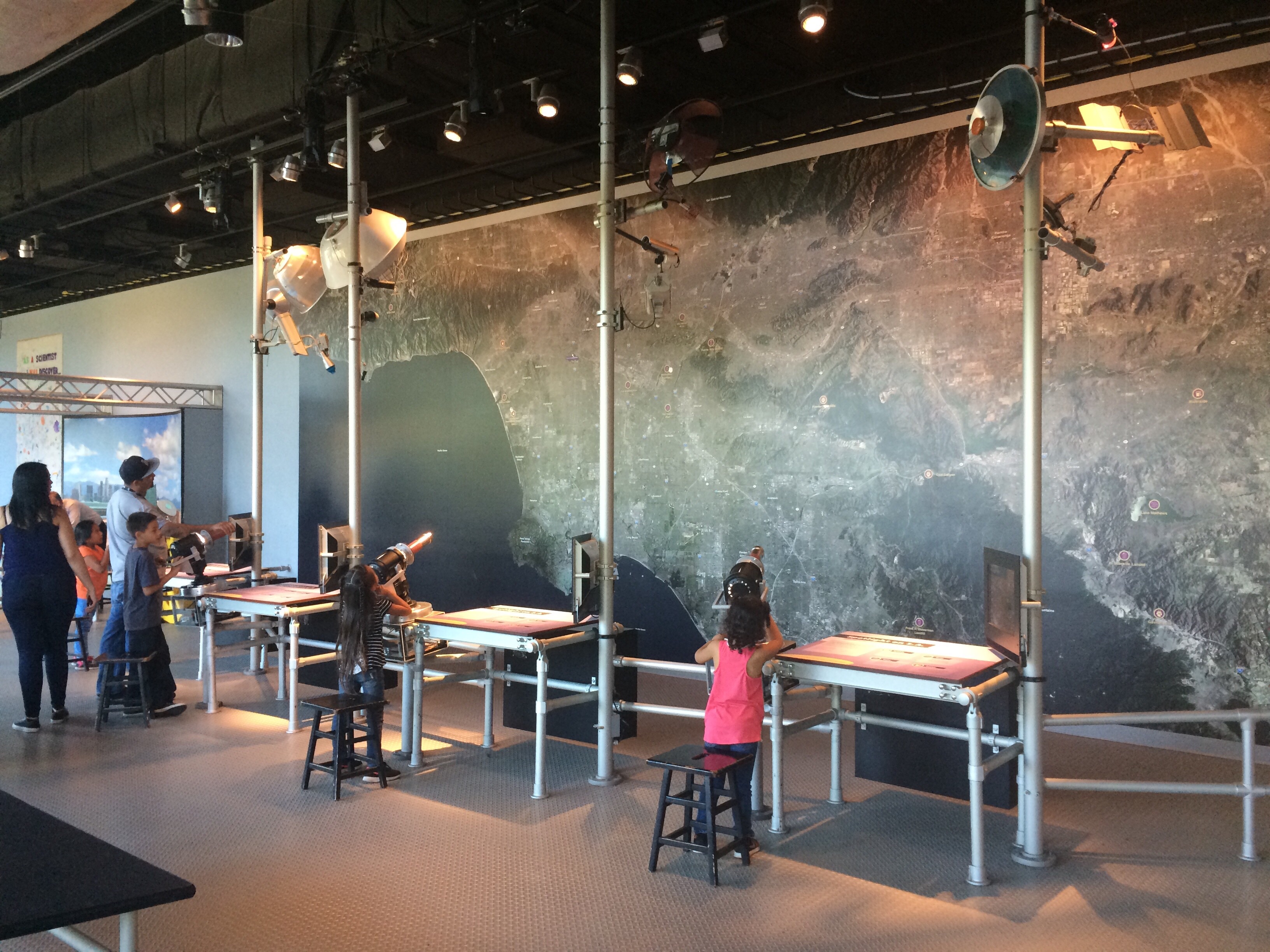
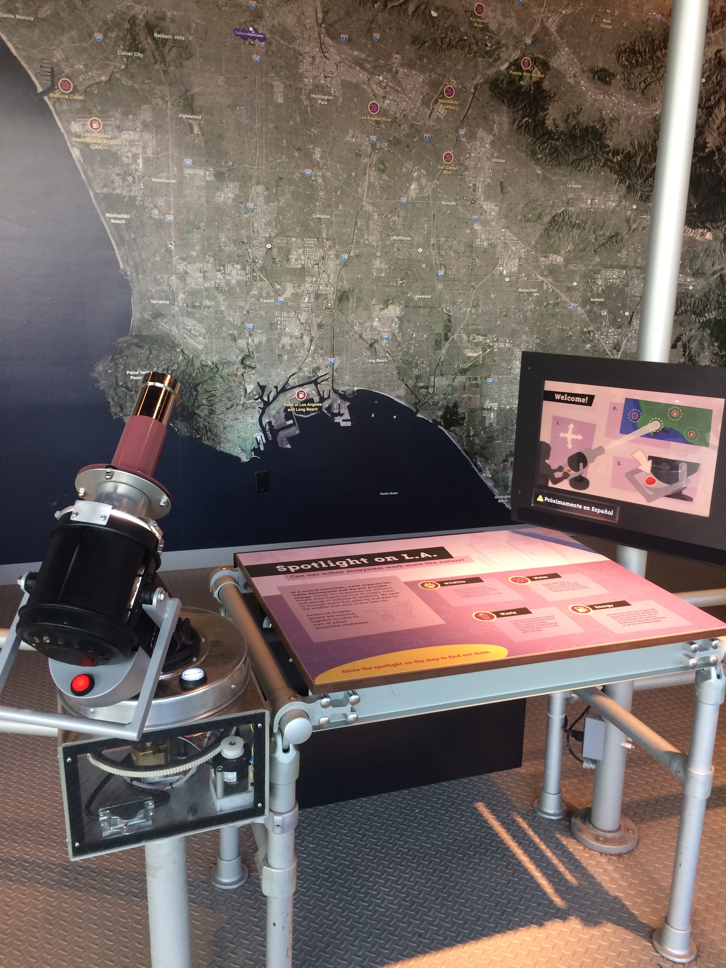
The L.A. Wall Map is a hands-on interactive developed for the California Science Center’s Ecosystems permanent exhibition.
This unique exhibit allows guests to learn more about the Los Angeles ecosystem by interacting with a giant, satellite view of the city by use of a custom-built input device.
The California Science Center welcomes over two million guests each year, requiring not only a highly engaging design, but rugged and reliable as well.
Goal
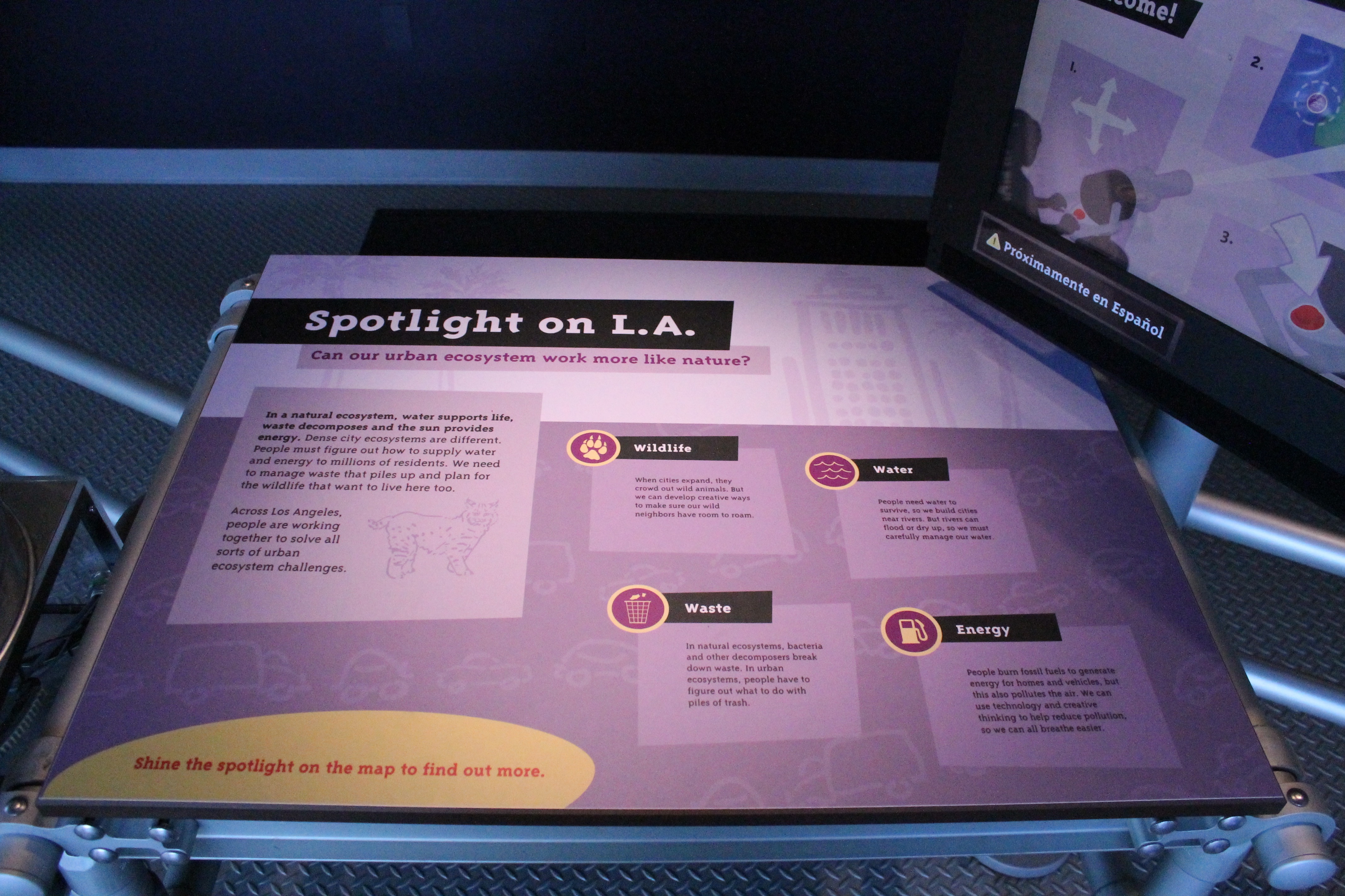
Teach Science Center guests themes about the Los Angeles ecosystem.
Create engaging, memorable activity for guests.
Challenges
Little interactivity - Previously installed 10’ x 30’ wall map did not offer guests an engaging way to interact with it, leading to little interest.
Pass-through area - Exhibit located near the exit, causing guests to pass by content presented here.
Intense usage - Facility hosts over two million guests per year, so hardware must be designed to operate constantly without breaking down.
Solution
Developed custom hardware/software interactive spotlight enabling guests to select points of
interest on the map to access themed A/V content.
Client says new exhibit “breathes life into the whole space.”